


BeSafe
UX/UI + BRANDING
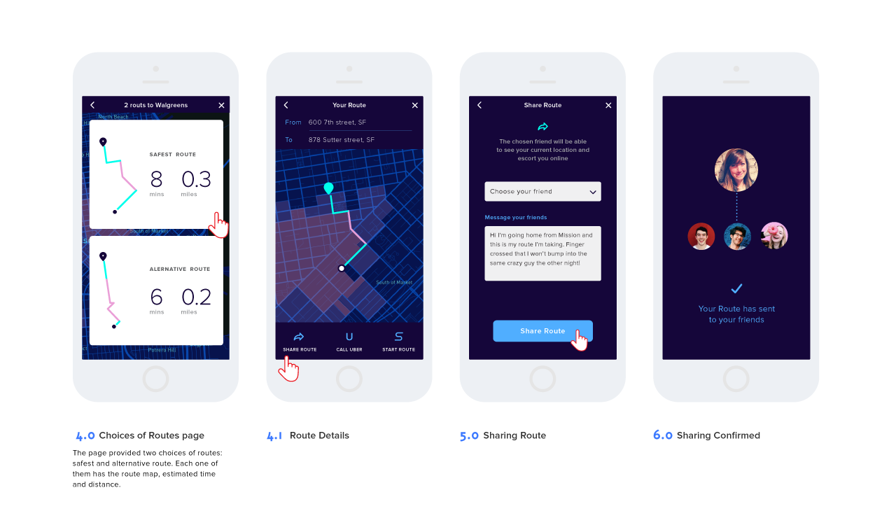
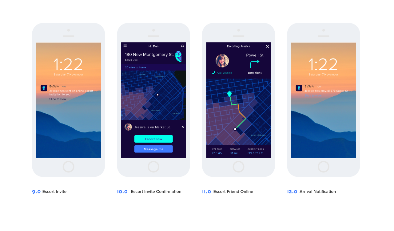
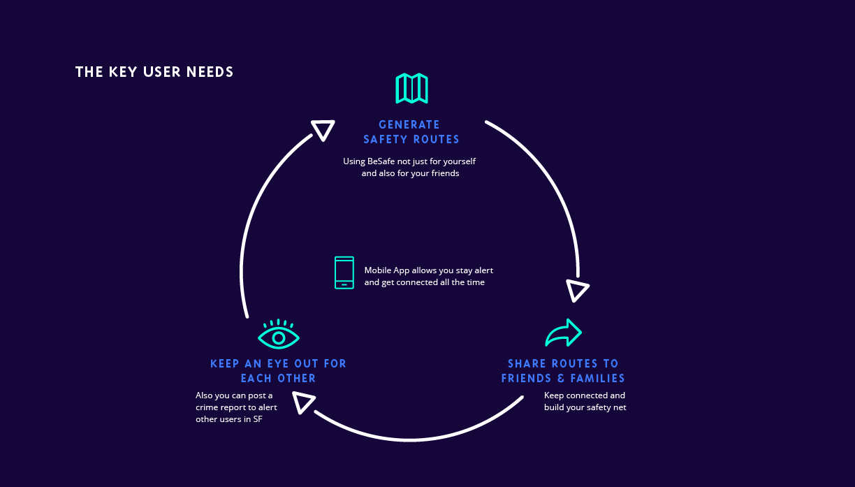
BeSafe is a real world application that generates safety routes in San Francisco based on government crime reports and user review. It also protects users from danger with their own social network by escorting each other online. The safety information can be instantly shared in this application and notify users what just happened and at where. Therefore, it is a safty net for people in San Francisco.
See my full thesis book
Try live prototype coded by me
See High Fidelity Wireframes
THE PROBLEM
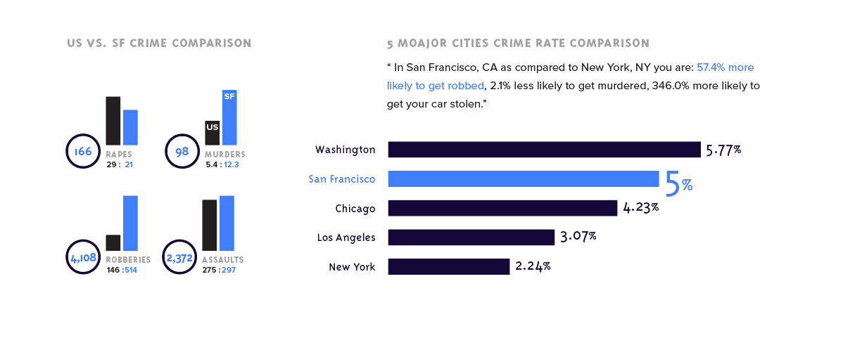
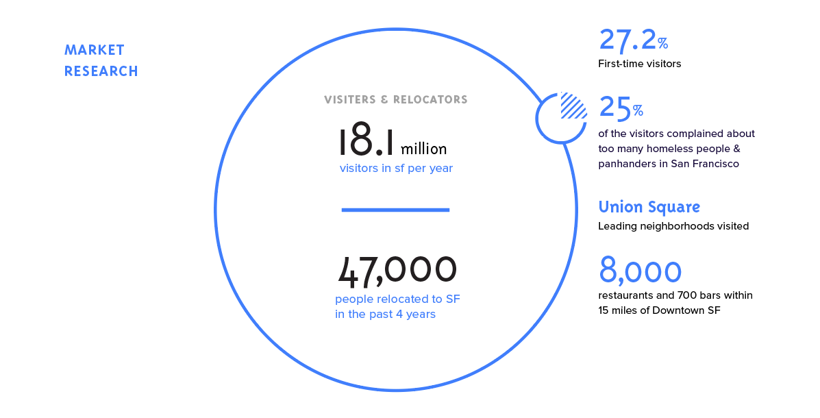
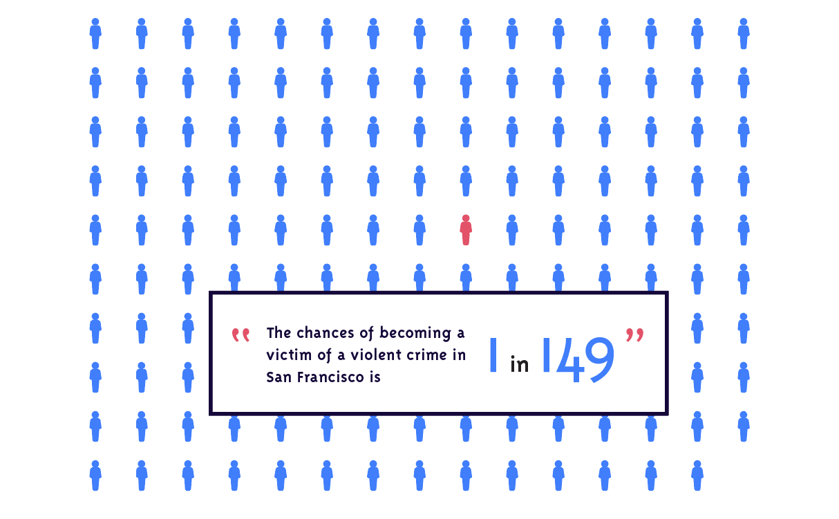
San Francisco is a beautiful city with amazing views and delicious food. The diversity of culture and unique ambiance attracts 16.5 million visitors per year. However, too many homeless people and panhandlers has became a well-known defect and was mentioned as the least liked part by one in four survey respondents (25.4%). It makes a bad impression and also poses a safety problem.
For example, the part of the city with the highest crime rate are the Tenderloin and Civic Center (as well as some areas of Western Addition and the Mission), which are right in the middle of the city. Market Street and Union Square, which are areas filled with startups and great shops, is unfortunately on the border of those areas. Due to this, going to work or going shopping you’re likely to have multiple people hit you up for money and you will probably meet a crackhead or two.


THE SOLUTIONS
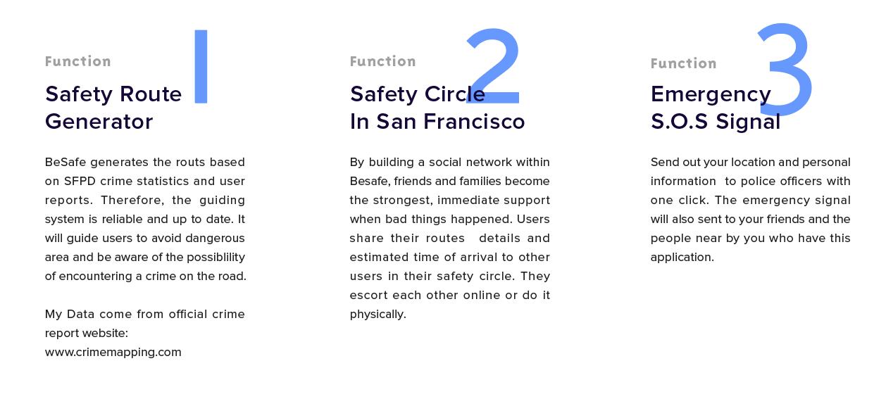
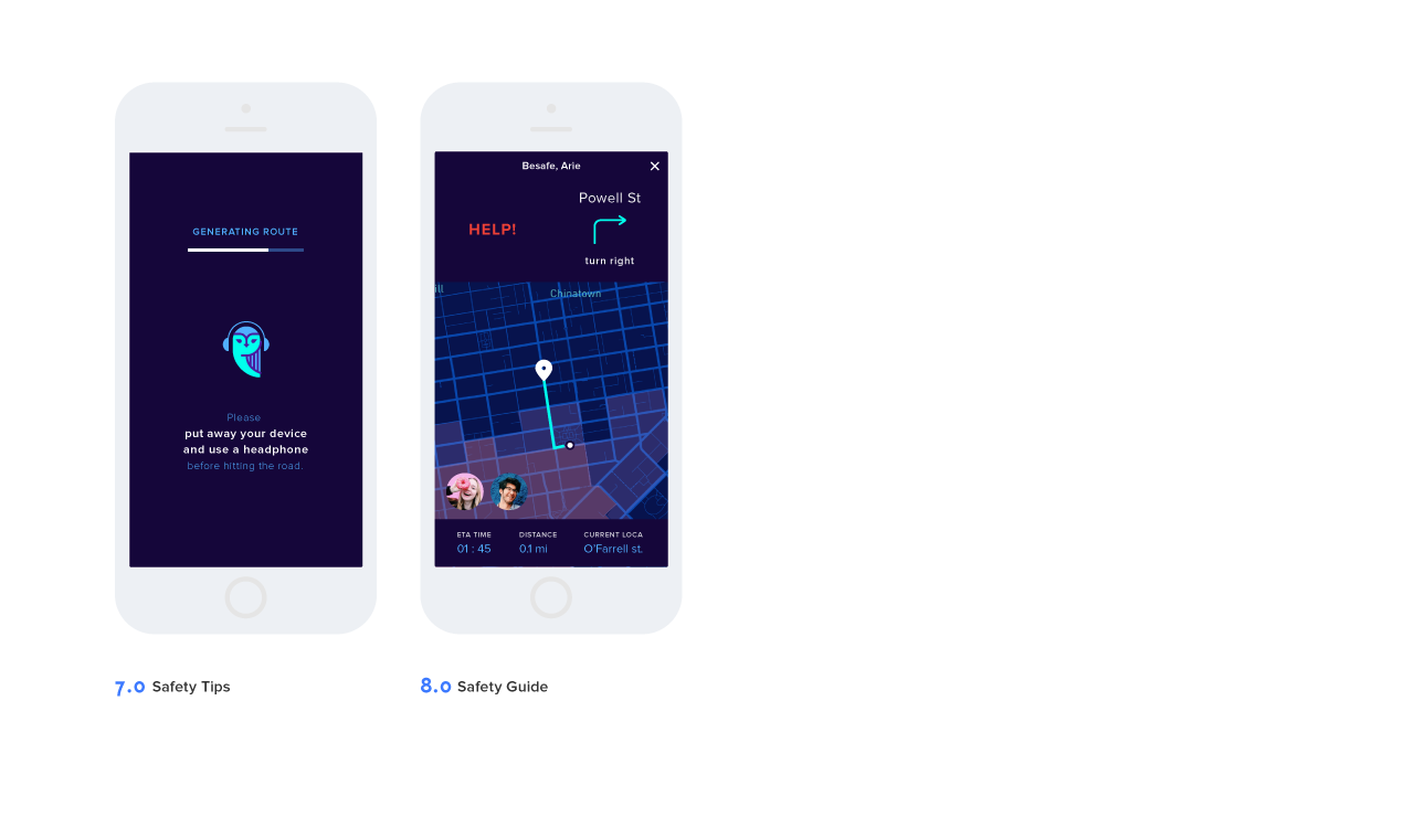
By implementing the three functions in BeSafe, we will be able to prevent the potential danger by avoiding sketchy area, having awareness of surroundings and reminding user with safety tips. And when the users are on the road, we need supports when incident happens. BeSafe allows users connected with friends and families and send out the emergency singal to ask for help.


STRATEGIC PROCESS
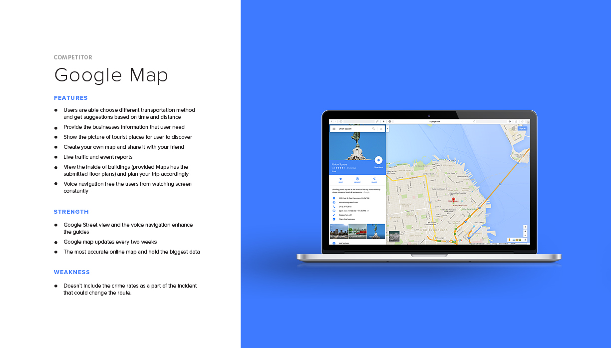
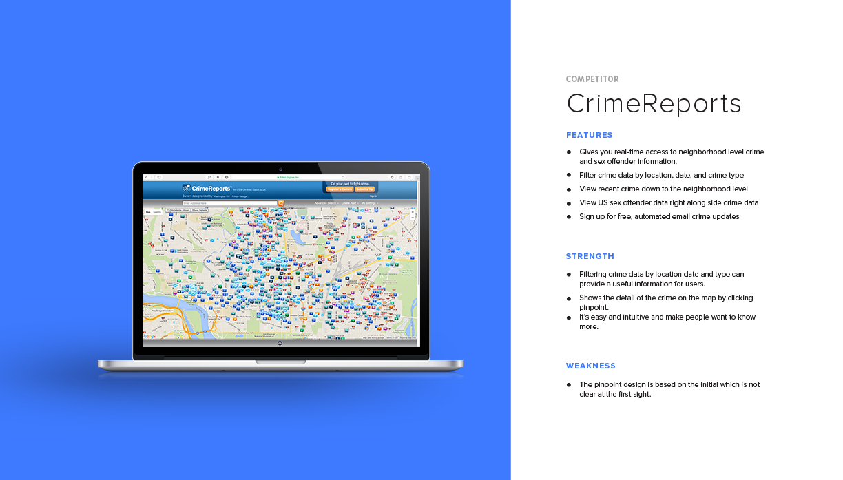
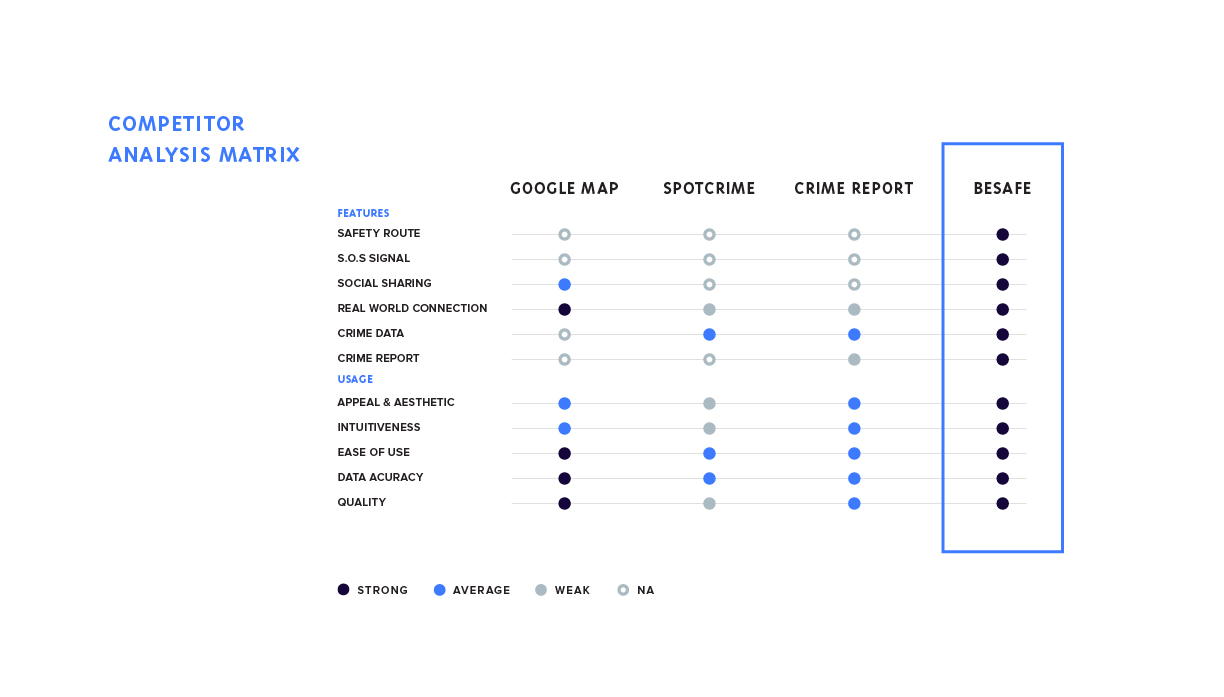
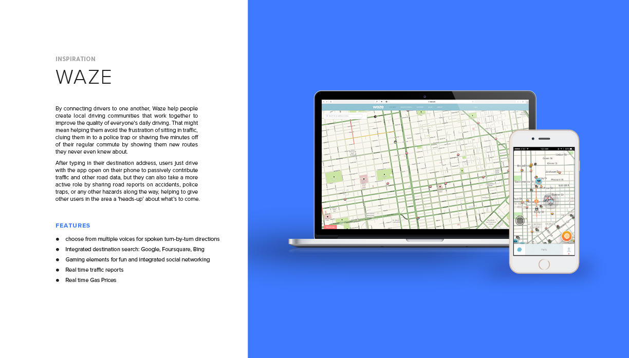
I compared three companies including Google map and CrimeReports with Besafe and see what are they offering. Google map is the best routing guide system in the market but it dosen't provide the safety information on the map. And because it calculates by the shortest distance and time, users can be easily guide through dangerous areas. On the other hand, CrimeReports is good for getting individual crime information. But when you look at the map, the data can be overwhelming and it dosen't tell you where to go. Therefore, BeSafe has a chance in the strategic standing point where it provides a guiding system that is based on crime reports and it doesn't overwhelm or scare users with data.

See my full thesis book
Try live prototype coded by me
See High Fidelity Wireframes